Are you planning a trip to Sweden's capital and wondering where to start?
A visit to Djurgården, Stockholm is an absolute must.
From world-class museums and historic ships to lush royal parklands, this island packs the very best of the city into one scenic spot. But with so much to see and do, knowing how to plan your visit can be overwhelming.
In this guide, you'll discover the must-see attractions, hidden gems, and practical insider tips to make the most of your time in Djurgården, Stockholm.
Let’s dive right in!
01 / THE STOCKHOLM GUIDE
The Djurgården Walking Loop at a Glance
The loop starts and ends at Djurgårdsbron and runs counter-clockwise around the western and central parts of Djurgården, inside the Royal National City Park.
- Trail MetricTerrain
- SpecificationFlat asphalt promenades, packed gravel trails, timber boardwalks
- Trail MetricPrimary Access Hub
- SpecificationDjurgårdsbron entrance (tram line 7 stops here)
Total Route Flow: From Djurgårdsbron and Back Along the Bay
Our master Royal Djurgården walking route begins at the iconic Djurgårdsbron entrance, tracing the island's perimeter in an unbroken, continuous loop:
THE LOOP AT A GLANCE
- The Western Cultural Bank Cross the bridge to sweep past the maritime docks and the museums by the water.
- The Southern Waterfront Promenade Skirt the Saltsjön shoreline for open-water views back across central Stockholm.
- The Royal Cape & Meadows Round the southern headland and turn inland into the parkland and old estates.
- The Northern Bay Shore Follow the south shore of Djurgårdsbrunnsviken westward back to the bridge.
- The Western Quarter (Urban & Cultural) Densely packed with world-class museums, restored naval yards, and lively entertainment piers.
- The Southern & Eastern Shorelines (Coastal & Maritime) Broad harbor pathways lined with century-old royal oaks, active shipping channels, and historic royal villas.
- The Central & Northern Interior (Pastoral & Protected) Quiet inland woodlands, palace gardens, bird sanctuaries, and the historic canal corridor that completely insulates you from city noise.
The outline is a schematic of the loop’s order and direction, not a map. Distances and shape are not to scale.
Directional Markers and Why Counter-Clockwise Works Best
Walking the loop counter-clockwise puts the museums and the waterfront first and saves the quieter parkland and the bay shore for the way back:
- Beating the Museum Crowds You pass the busy western museum quarter early in the walk.
Orientation Across the Stockholm Royal National City Park
Djurgården forms the crown jewel of the world's first national city park. Understanding its spatial layout makes on-the-ground navigation intuitive:
Leg 1: Djurgårdsbron to the Western Cultural Quarter
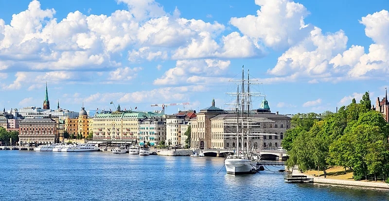
We begin by crossing Djurgårdsbron, the ornate bridge decorated with sculpted Norse gods. As you cross, glance back over your shoulder for one of the best views in the city: the boulevard of Strandvägen curving along the water of Nybroviken.
Crossing Djurgårdsbron into Royal Djurgården
Once over the bridge, you are on Djurgården, part of the Royal National City Park. The ground here is paved and flat, an easy start for any walker.
- Wayfinding cue Keep to the right side of the pedestrian walkway to avoid the busy bike lane.
- Immediate fork Djurgårdsvägen runs straight ahead toward the tram line, but we branch right onto the cobblestone path descending toward the water.
Nordiska Museet Forecourt and Approach Paths
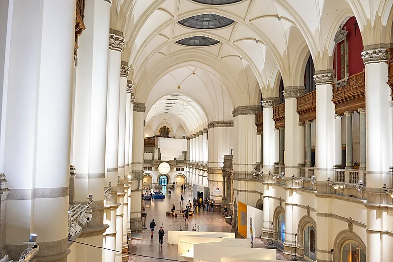
Directly ahead stands the huge, cathedral-like facade of the Nordiska Museet. The forecourt has wide gravel paths and neat lawns in front of the building’s towers.
- Walking direction Instead of heading up the central museum steps, follow the curving path along the museum's northern wall.
- Key sight Notice the bronze equestrian statue of King Karl X Gustav in front of the museum before the trail dips down to the quay.
Vasa Museum Quayside and Galärvarvsparken Waterfront
Descending to the shoreline brings us directly to the Vasa Museum quayside and the open lawns of Galärvarvsparken. This paved promenade runs directly along the water's edge, offering uninterrupted views across the harbor toward Skeppsholmen.
Here the trail turns from city street into a waterside walkway, with benches along the way.
02 / THE STOCKHOLM GUIDE
The Galärvarvet Quay and Its Historic Ships
Past the Vasa Museum, the quay leads into the former naval dockyards of Galärvarvet, where preserved historic ships are moored along the wooden piers.
This compact stretch holds the highest concentration of things to do in Djurgården Stockholm. From the wooden moorings outside the Spritmuseum, the trail stays along the shoreline, ready to wind past the historic boat houses toward the southern entertainment shore.
Historic Naval Docks and Veteran Vessels
Past the Vasa Museum, the quay leads into the former naval dockyards of Galärvarvet, where preserved historic ships are moored along the wooden piers.
MOORED AT GALÄRVARVET
Icebreaker Sankt Erik A preserved steam icebreaker moored at the quay.MOORED AT GALÄRVARVET
Lightship Finngrundet A former lightship, moored alongside.
This compact stretch holds the highest concentration of things to do in Djurgården Stockholm. From the wooden moorings outside the Spritmuseum, the trail stays along the shoreline, ready to wind past the historic boat houses toward the southern entertainment shore.
Decide which of the island’s museums to go intoPlanning the Vasa Museum itself
03 / THE STOCKHOLM GUIDE
Leg 2: Gröna Lund, ABBA The Museum and the Harbor Shore
Leg 2 follows the shore south toward the harbor, past Allmänna gränd, Gröna Lund, ABBA The Museum and the edge of Skansen.
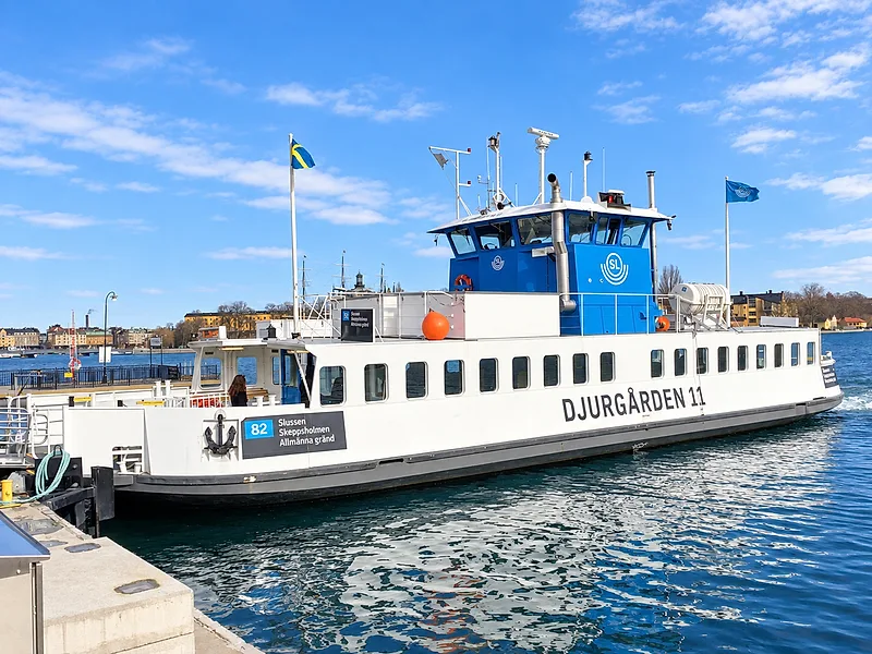
Saltsjön Harbor Views and Allmänna Gränd Wayfinding
Following the waterfront walkway toward Allmänna Gränd, the trail delivers uninterrupted Saltsjön harbor views.
- Gamla Stan Panorama Look southwest across the water to spot the copper church spires of Stockholm's Old Town.
- Södermalm Cliffs The sheer granite bluffs of Södermalm and the historic buildings along Fjällgatan rise directly opposite the channel.
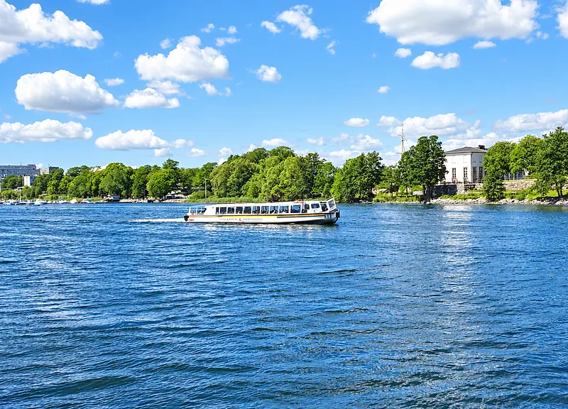
- Active Waterway Watch vintage steamships, Djurgården ferries (Djurgårdsfärjan), and archipelago cruisers navigate the main channel.
Historic Djurgårdsstaden and Gröna Lund Boardwalk
Step one block inland behind the promenade to enter Djurgårdsstaden, a quiet grid of red and ochre wooden houses.
Landmark
Allmänna Gränd Ferry Slip
- Location
- Waterfront at Gröna Lund
- Walking Route Note
- Ferry line 82 stops here on its way to and from Slussen
Landmark
Djurgårdsstaden Quarters
- Location
- Between Breda Gatan and Långa Gatan
- Walking Route Note
- Cobblestone lanes between homes; keep your voice down
Landmark
Gröna Lund Shoreline
- Location
- Lilla Allmänna Gränd
- Walking Route Note
- Narrow seaside boardwalk with direct water views
Right beside it along the shore, the route follows the waterfront edge of Gröna Lund, Sweden’s oldest amusement park.
Cultural Anchors: ABBA The Museum and Skansen Perimeter
Moving slightly inland onto Djurgårdsvägen puts you directly between two major Stockholm attractions:
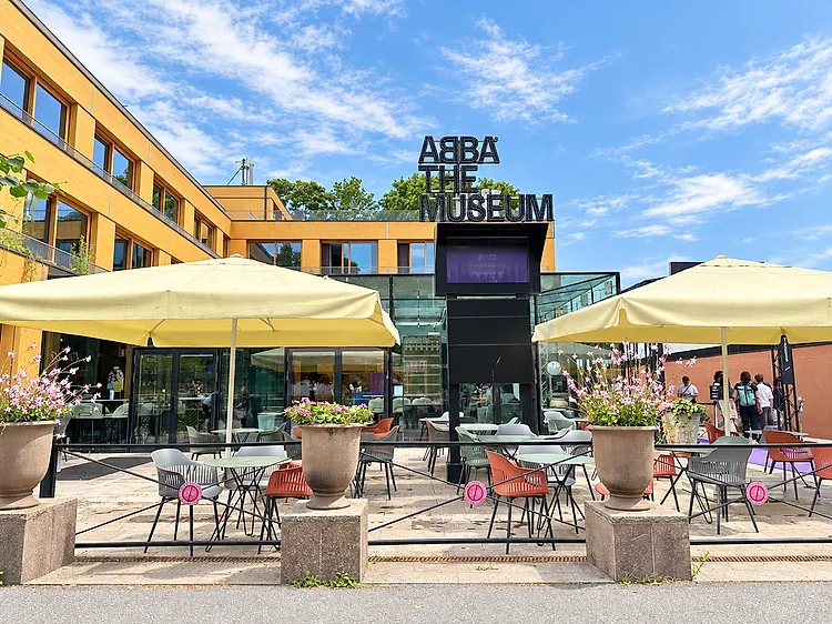
BY DJURGÅRDSVÄGEN
ABBA The Museum
On Djurgårdsvägen, the interactive museum about the band and Swedish pop.
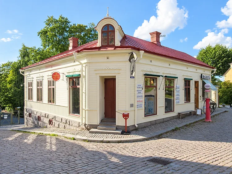
BY DJURGÅRDSVÄGEN
Skansen
The open-air museum’s wooded grounds rise on the hill across the road.
04 / THE STOCKHOLM GUIDE
Leg 3: The Southern Headland and Waldemarsudde
Leg 3 follows Prins Eugens väg along the water to the southern tip of Djurgården and the grounds of Prins Eugens Waldemarsudde.
Following the Prins Eugens Väg Waterside Trail
The path hugs the waterline, offering an easy, scenic stroll along the edge of the southern cape.
- Path Surface Smooth asphalt transitions into firm, well-kept gravel walking tracks.
- Wayfinding Keep the water on your right-hand side as the trail bends south-southeast.
- Atmosphere Noticeably quieter and less crowded than the western museum strip, filled with fresh sea air.
Archipelago Shipping Channel Vistas and Royal Oaks
As we round the cape, panoramic vistas open across the primary shipping channel connecting central Stockholm to the Baltic archipelago.
- Old Royal Oaks Huge, protected old oak trees line the southern trail.
- Maritime Traffic Watch large Baltic passenger ferries, archipelago shuttles, and sailing boats navigate the narrow channel toward Saltsjön.
- Scenic Viewpoints Shaded wooden benches sit right against the shoreline, offering clear vantage points across to Nacka strand and the southern cliffs.
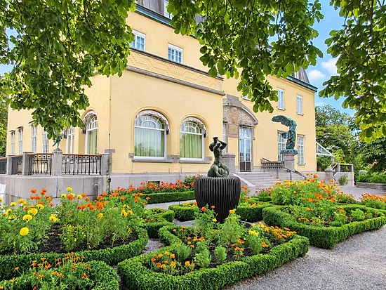
Prince Eugen's Waldemarsudde Sculpture Grounds and Terraces
We step up onto the estate headland of Prins Eugens Waldemarsudde, one of Sweden’s premier art and garden locations.
- FeatureSculpture Grounds
- What to ExploreBronze sculptures set against the lawns by the water.
- FeatureWaterfront Terraces
- What to ExploreStone balustrades lined with seasonal plantings and harbor outlooks.
- FeatureHistoric Oil Mill
- What to ExploreThe old oil mill standing on the rocky ridge above.
The terraces and lawns make this headland a good place for a break before you turn inland toward the central park trails.
05 / THE STOCKHOLM GUIDE
Leg 4: Inland Trails and Rosendal’s Gardens
Leg 4 turns north into the island’s green interior, past Bellmansro and Isbladskärret, to the gardens, orchards and glasshouses at Rosendal.
These inner Stockholm pedestrian trails showcase the true dual nature of djurgarden stockholm, shifting the hike from coastal harbor views to rolling, pastoral parkland that feels miles away from the city center.
Transitioning Inland to Pastoral Parkland Meadows
Leg 4 turns north into the island’s green interior, past Bellmansro and Isbladskärret, to the gardens, orchards and glasshouses at Rosendal.
These inner Stockholm pedestrian trails showcase the true dual nature of djurgarden stockholm, shifting the hike from coastal harbor views to rolling, pastoral parkland that feels miles away from the city center.
- Trail Surface Shifts from wide paved paths to hard-packed gravel and packed dirt.
- Wayfinding Head for Rosendal and Bellmansro.
- Visual Landmarks Rolling grass meadows framed by old oaks.
Scenic Paths Around Bellmansro and Isbladskärret
Follow the track northeast past Bellmansro toward the Isbladskärret wetland, known for its colony of grey herons.
Waypoint
Bellmansro
- Direction & Terrain
- Inland from the southern shore
- Key Highlight
- Oak groves and quiet shaded paths
Waypoint
Isbladskärret Wetland
- Direction & Terrain
- Continue northeast
- Key Highlight
- Grey herons, waterfowl and reed beds
Waypoint
Rosendal Approach
- Direction & Terrain
- Curve westward along the field line
- Key Highlight
- Open views across the royal pastures
Stay on the marked paths through this section to protect the sensitive marshland ecosystem. The flat terrain makes for effortless pacing before we turn west toward the royal estate.

Rosendal Palace Gardens, Orchards, and Glasshouses
The trail opens into the grounds of Rosendal, the palace and gardens built for King Karl XIV Johan.
The estate grounds feature:
- The Royal Palace (Rosendals Slott) A premier Swedish example of the European Empire style, standing quietly against the northern tree line.
- Orchard Fruit trees in the garden’s orchard.
- Biodynamic Glasshouses Surrounding garden beds filled with seasonal florals, herbs, and heritage vegetables.
- Gravel Garden Lanes Clear, wide walking corridors lined with rustic wooden benches beneath broad canopies.
We follow the central garden axis west, keeping the glasshouses on our left and the palace lawns to our right, toward the shore of Djurgårdsbrunnsviken.
06 / THE STOCKHOLM GUIDE
Leg 5: Along Djurgårdsbrunnsviken Back to the Bridge
The last leg follows the south shore of Djurgårdsbrunnsviken west on a flat, shaded gravel path back to Djurgårdsbron.
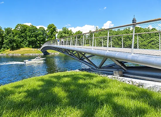
The Bay Shore and Its Footbridge
Walking the bay shore toward the bridge is one of the quietest stretches on Djurgården:
- Folke Bernadottes Bro Near Rosendal you pass the end of this footbridge, which crosses the bay to Norra Djurgården.
- Trail Rhythm Stick to the water-facing side of the path and leave room for runners and cyclists to pass.
Diplomatic Quarter Panoramas Back to Djurgårdsbron
As you walk west, the bay opens up and the views widen across the water.
- Northern Shore Views Look across the bay to Diplomatstaden, the Diplomatic Quarter, with its embassy villas along the waterfront.
- The Final Approach The shoreline path leads you back to Djurgårdsbron to complete the loop.
07 / THE STOCKHOLM GUIDE
Shorter or Longer: Two Route Options
Choose the half-day route for the museums and the waterfront, or the full-day loop around the island’s edge.
Route Option · Express Cultural Loop
Express Half-Day Museum and Waterfront Route
If you have half a day on the island, this compact loop covers the core of Djurgården without straying far from the tram.
- Best For
- First-timers, museum lovers
- Key Landmarks
- Vasa Museum, Nordiska Museet, Galärvarvsparken, Gröna Lund shore
- Start at Djurgårdsbron Cross the bridge and veer right past the Nordiska Museet forecourt.
- Follow the Galärvarvsparken waterfront Walk behind the Vasa Museum quayside toward the historic dockyards.
- Skirt the entertainment strip Continue along the coastal promenade past the historic wooden homes of Djurgårdsstaden and the Skansen open-air park perimeter.
- Cut back through central parkland Turn north near Djurgårdsvägen, crossing through the open meadows back to the bridge.
Pacing tip: leave room for one major indoor stop, such as the Vasa Museum or ABBA The Museum.
Route Option · Grand Perimeter Loop
Full-Day Grand Perimeter Loop
For the whole island, natural and royal, set aside a full day for this outer loop.
- Best For
- Walkers, nature lovers
- Key Landmarks
- Waldemarsudde, Rosendal, Isbladskärret, Djurgårdsbrunnsviken shore
- Southern Shoreline (Djurgårdsbron to Waldemarsudde) Follow the water’s edge along Saltsjön, with views across to Södermalm, until you reach Prins Eugens Waldemarsudde.
- Central Meadows (Waldemarsudde to Rosendal) Turn inland along the gravel lanes toward Rosendal. Stop for fika at the garden café.
- Wetland and Bay (Isbladskärret to the Bay Shore) Walk around Isbladskärret for the birdlife, then follow the south shore of Djurgårdsbrunnsviken west.
- Northern Return Keep to the flat bay-shore path, with Diplomatstaden across the water, back to Djurgårdsbron.
08 / THE STOCKHOLM GUIDE
Trail Etiquette, Shoes and Seasons
Keep to the walking side of shared paths, wear shoes that suit both paved promenades and gravel, and check the season before you set out.
Navigating Shared Pedestrian and Cycling Trails
Djurgården's paths are heavily used by daily bike commuters, runners, and leisurely strollers. To keep your walk smooth and stress-free:
- Stay to the right on divided paths Paved sections near Djurgårdsvägen and the western museum hub have clearly marked bike lanes. Keep off the asphalt bike tracks and stick to the pedestrian pavement.
- Listen for bike bells on interior gravel routes Shared paths through the parkland and along the bay shore do not have painted lines. Move to the right when a cyclist rings.
- Watch the speed zones around transport hubs Electric bikes and shared scooters cluster around tram stops and museum entryways. Stay alert when stepping off curbs or turning corners near transit plazas.
Footwear Advice for Paved Promenades and Gravel Trails
A full loop around Djurgården Island shifts constantly between smooth waterfront boardwalks, historic cobblestones, and crushed-stone park trails.
- Cushioned walking shoes Lightweight running shoes or supportive walking sneakers are ideal for the full loop. Stiff hiking boots are unnecessary on these well-graded paths.
- Low-profile trail runners for mixed weather On the dirt tracks around Isbladskärret or the bay shore after rain, a water-resistant trail runner copes with mud and damp grass.
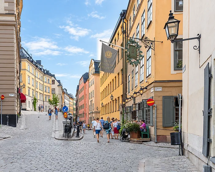
- Flat, grippy soles for historic alleys The preserved residential streets around Djurgårdsstaden feature uneven, heritage cobblestones that can become slippery when wet.
Seasonal Guide for Royal Djurgården Walks
Djurgården transforms dramatically throughout the year. Use this seasonal breakdown to match your walking plans with Stockholm's changing conditions:
Season
Spring (Apr–May)
- Trail Conditions
- Dry paved paths; occasional soft dirt on interior loops
- Landscape Highlights
- Blooming apple orchards at Rosendal and budding oak forests
- What to Pack
- Windbreaker, sunglasses, and mid-weight layers
Season
Summer (Jun–Aug)
- Trail Conditions
- Firm, dry gravel and packed dirt throughout
- Landscape Highlights
- Extended daylight, lush green canopy, and bustling waterfront terraces
- What to Pack
- Water bottle, sun hat, and light breathable shoes
Season
Autumn (Sep–Nov)
- Trail Conditions
- Damp leaf-covered tracks and misty shoreline
- Landscape Highlights
- Deep gold and amber foliage across the royal oak groves
- What to Pack
- Water-resistant walking shoes, thermal mid-layer, and a rain shell
Season
Winter (Dec–Mar)
- Trail Conditions
- Snow-packed trails with occasional icy patches
- Landscape Highlights
- Stark, quiet coastlines and frozen bay views
- What to Pack
- Insulated boots with good tread, slip-on ice grips (broddar), and warm gloves
09 / THE STOCKHOLM GUIDE
Frequently Asked Questions About Djurgården
How long does it take to walk around Djurgården?
It depends on whether you walk the whole shoreline or stay in the western museum quarter:
- Full Grand Loop Allow half a day of walking along the outer shoreline and the bay.
- Western Cultural Loop A shorter walk around the museum quarter and the waterfront.
- Full-Day Sightseeing Pace If you plan to visit museums, stop for fika at Rosendal or explore the sculpture grounds, plan on a full day on the island.
Is Djurgården free to enter and explore on foot?
Yes. Walking the island’s paths and promenades costs nothing; you pay only when you go into museums and attractions such as the Vasa Museum, Skansen or ABBA The Museum.
What is the best starting point for a Djurgården walk?
Djurgårdsbron, the bridge from Strandvägen, is the easiest place to start.
- Transit Tram line 7 stops at Djurgårdsbron.
- Trail split Head right for the southern waterfront promenade, or left for the shore of Djurgårdsbrunnsviken.
Can you walk to Djurgården directly from central Stockholm?
Yes, walking from central Stockholm is scenic and straightforward. The most popular route follows the harbor along Strandvägen:
- From Nybroplan A short, flat walk along the Strandvägen waterfront to Djurgårdsbron.
- From T-Centralen (Central Station) Head east through Kungsträdgården and along Strandvägen.
- From Gamla Stan (Old Town) Walk along the quays, or take the public Djurgården ferry (line 82) from Slussen to Allmänna Gränd.
BEFORE YOU GO
A flexible plan is a better plan.
Opening hours, admission policies, services and access can change. Check each attraction’s official website and the SL journey planner before travelling. Suggested times in this guide are planning estimates, not venue opening hours or guaranteed transfer times.
SOURCES
- world's first national city parkroyaldjurgarden.se
- the ornate bridge decorated with sculpted Norse godsstockholmskallan.stockholm.se
- A preserved steam icebreaker moored at the quaysjohistoriska.se
- Sweden’s oldest amusement parkgronalund.com
- On Djurgårdsvägenabbathemuseum.com
- the grounds of Prins Eugens Waldemarsuddewaldemarsudde.se
- the gardens, orchards and glasshouses at Rosendalrosendalstradgard.se
- known for its colony of grey heronsroyaldjurgarden.se
- the palace and gardens built for King Karl XIV Johankungligaslotten.se
- which crosses the bay to Norra Djurgårdensustainable.royaldjurgarden.se
- Tram line 7 stops at Djurgårdsbronsl.se
- take the public Djurgården ferry (line 82) from Slussen to Allmänna Grändroyaldjurgarden.se
Last verified .
PHOTOGRAPHS & LICENCES4
- Djurgårdsbrunnsviken juni 2019.jpg — Holger.Ellgaard · CC BY-SA 4.0, via Wikimedia Commons. Brightened and colour-adjusted for this page; cropped to fit. The edited version is shared under the same licence.
- Prins Eugens Waldemarsudde, september 2021c.jpg — Bysmon · CC BY-SA 4.0, via Wikimedia Commons. Brightened and colour-adjusted for this page; cropped to fit. The edited version is shared under the same licence.
- Greenhouse in Rosendals trädgard, 17.08.2015.jpg — Liberaler Humanist · CC BY-SA 3.0, via Wikimedia Commons. Brightened and colour-adjusted for this page; cropped to fit. The edited version is shared under the same licence.
- Folke Bernadottes bro, juli 2020a.jpg — Holger.Ellgaard · CC BY-SA 4.0, via Wikimedia Commons. Brightened and colour-adjusted for this page; cropped to fit. The edited version is shared under the same licence.