01 / THE STOCKHOLM GUIDE
Södermalm Walking Route at a Glance
The Södermalm loop takes half a day on foot, or a full day with stops, in five legs: the northern cliffs at Monteliusvägen, Mariatorget, Skinnarviksberget and Tantolunden, SoFo around Nytorget, and the eastern slopes down to Fotografiska.
Route Specifications & Logistics
- Walking Time
- Half a day for the walk itself; a full day if you stop for coffee, museums and scenic pauses.
- Primary Transit Connections
- Slussen, Mariatorget, and Medborgarplatsen metro stations serve as straightforward entry and exit points for the circuit.
- Terrain Profile
- Mixed paved sidewalks, cobblestone alleyways, cliff paths, and natural stone outcrops with intermittent stair climbs.
Waypoint Sequence Across Five Distinct Legs
FIVE LEGS, ONE LOOP
North
Route Stage
- Core Highlights
- Old wooden houses, a cliff path above the water
- Key Waypoints & Landmarks
- Monteliusvägen, Bastugatan, Bellmansgatan
Centre
Route Stage
- Core Highlights
- Neighborhood square, residential architecture
- Key Waypoints & Landmarks
- Mariatorget Square, Sankt Paulsgatan, Swedenborgsgatan
West
Route Stage
- Core Highlights
- Open-rock summits, garden allotments, waterfront trails
- Key Waypoints & Landmarks
- Skinnarviksberget, Tantolunden, Årstaviken shoreline
South
Route Stage
- Core Highlights
- Nytorget square and the streets around it
- Key Waypoints & Landmarks
- Nytorget, South of Folkungagatan, Bondegatan
East
Route Stage
- Core Highlights
- Preserved wooden houses, a hilltop park, the quay
- Key Waypoints & Landmarks
- Vitabergsparken, Sofia Church, Fotografiska waterfront
Each leg is placed by the direction in its own name. The dashed line is the walk back along the water. Not a map.
This five-stage circuit runs from the northern clifftops down through the neighborhood squares, then out to the parks and back along the water.
02 / THE STOCKHOLM GUIDE
Leg 1: Monteliusvägen and the Old Wooden Houses
WHERE THE WALK BEGINS
Starting on the Monteliusvägen Cliff Path
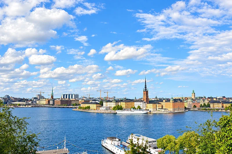
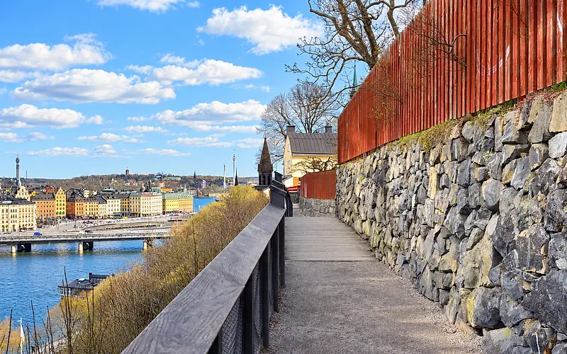
The route begins along Monteliusvägen, the cliffside path on the northern edge of Södermalm, with City Hall across the water and Gamla Stan to the northeast. The footway runs along the rock face behind safety railings before the route heads deeper into the island.
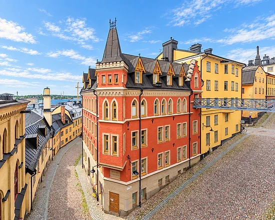
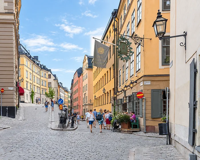
Old Wooden Houses and Cobblestone Alleys
Stepping just a few paces back from the ridge brings you directly into preserved historic enclaves:
- Wooden Houses Old painted wooden houses tucked among the lanes.
- Cobblestone Passages Quiet cobblestone residential lanes.
- Historical Contrast A visual link between working-class Södermalm and the modern city below.
Descending Inland Toward the Central Spine
Leaving the cliff paths behind, the route drops steadily down stone steps and sloping alleyways toward the island’s central transit spine:
- Direct Access A short, continuous descent leads directly down to Hornsgatan and the streets framing Mariatorget.
- Terrain Shift The trail transitions smoothly from exposed rock formations and timber houses into classical brick and stone tenement facades.
- Urban Flow You land right at the threshold of local fika spots, specialty bakeries, and busy transit hubs ready for the next stretch of the walk.
03 / THE STOCKHOLM GUIDE
Leg 2: Mariatorget and Sankt Paulsgatan
The second leg runs from the foot of the cliffs to Mariatorget, a park square that is the everyday centre of this side of the island, and east along Sankt Paulsgatan, a street of stone facades, bakeries and fika spots.
Mariatorget
THE SQUARE
Local Life Around Mariatorget Square
Mariatorget acts as the everyday anchor for this side of the island. The park square fills with residents meeting on benches, walking dogs, and catching up on pedestrian-friendly side streets.
Sankt Paulsgatan
EAST ALONG THE SOUTH SIDE
Strolling the Residential Facades of Sankt Paulsgatan
Walking east along Sankt Paulsgatan, on the south side of the square, broad stone architecture frames wide, easy-to-walk sidewalks. The street-level routine revolves around daily bread and traditional fika.
04 / THE STOCKHOLM GUIDE
Leg 3: Skinnarviksberget, Tantolunden and the Shore
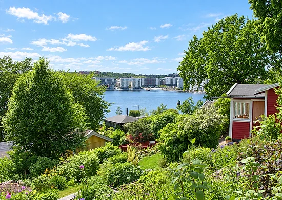
The third leg climbs Skinnarviksberget, the highest natural viewpoint on Södermalm, then drops through the allotment gardens of Tantolunden to the level paths along the water.
1 · THE HEIGHTS
A Short Climb onto Skinnarviksberget
Head up the trails toward Skinnarviksberget, the highest natural viewpoint in Södermalm, and pause on the bare rock before moving on. The paths to the top are natural and uneven, so watch your footing.
2 · THE PARK
Meandering Through Tantolunden's Allotment Garden Trails
From the heights of Skinnarviksberget, the route descends southward into Tantolunden, a large park on the island. The trails wind past allotment gardens that showcase Södermalm's green heritage.
- Garden Allotments Dozens of preserved wooden cottages tucked behind lush, cultivated garden plots along terraced hillsides.
- Walking Trails Shaded paths cutting through mature trees, offering a quiet escape from the urban core.
- Park Living Expansive lawns where locals exercise, stroll, and enjoy the greenery throughout the day.
3 · THE SHORE
Connecting to the Lower Shoreline Walking Paths
The descent through Tantolunden leads directly to the lower perimeter of the island. Joining the shoreline trails along the water’s edge provides flat, open terrain and a close connection to the waterfront.
- Waterfront Paths Wide, level walking trails running along the edge of the bay, ideal for a steady walking pace.
- Water Access Direct access to shoreline piers and popular local swimming spots along the park border.
- Route Flow A smooth waterside stretch that sets up an easy eastward pivot back into the central neighborhoods.
05 / THE STOCKHOLM GUIDE
Leg 4: SoFo and Nytorget
Heading east brings you into SoFo, the blocks south of Folkungagatan, where independent design studios and record shops take the place of chains and Nytorget is the square at the centre.
Nytorget
SOUTH OF FOLKUNGAGATAN
Café Life Around Nytorget Square
Nytorget serves as the central gathering point of SoFo. The square stays active throughout the day, bordered by open lawns and corner bistros that make it an ideal stop for observing local life.
06 / THE STOCKHOLM GUIDE
Leg 5: Vita Bergen and Down to Fotografiska
The last leg climbs past old wooden cottages to Vitabergsparken, a hilltop park with an open-air theatre, then heads north down to the Stadsgården quay and Fotografiska and back along the water to Slussen.
UP, THEN DOWN TO THE WATER
- Climbing Past Old Wooden Cottages
- Vitabergsparken’s Hilltop Lawns
- Down to the Stadsgården Quay and Fotografiska
The guide gives the order, up and then down, but no heights, so the curve is a shape, not a measurement.
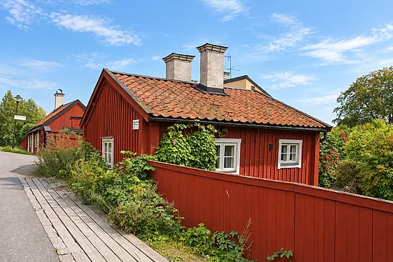
Climbing Past Old Wooden Cottages
The climb into eastern Södermalm leads onto quieter lanes. As the paved avenues give way to narrow, winding paths and staircases, the landscape turns to clusters of old wooden cottages.
- Preserved Wooden Architecture These slopes preserve the red-timber cottages that once housed the island's working-class communities.
- A Quiet Pace Unlike the busy café streets nearby, these hillside lanes keep a village-like atmosphere, ideal for slow exploration on foot.
Vitabergsparken’s Hilltop Lawns
Reaching the crest brings you into Vitabergsparken, a hilltop park that combines rugged granite outcrops with open, rolling lawns.
- High Vantage Point The hilltop looks out over the city.
- Open-Air Heritage The park centers around its open-air theater, which hosts performances during the summer months.
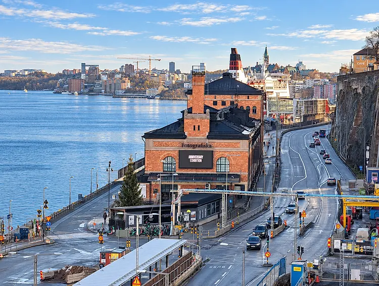
Down to the Stadsgården Quay and Fotografiska
From Vita bergen the route heads north, down to the Stadsgården quay on the island's northern shore.
- Fotografiska The photography museum sits on this stretch of waterfront near Slussen, inside the old customs house.
- Waterfront Embankment Walk The flat stretch along the quay leads back westward, with views across the harbor toward Gamla Stan.
- Completing the Loop This sea-level stretch ties the eastern ridges back to Slussen, closing the island circuit along the waterline.
07 / THE STOCKHOLM GUIDE
Tips for Walking Södermalm
Wear supportive shoes for the cobblestones, stairs and bare rock, walk the loop in the order above, and choose between a half-day stroll and a full day that adds Tantolunden, Vitabergsparken and Fotografiska.
Managing Terrain Shifts, Cobblestones, and Steep Stairways
Södermalm rises sharply from the water, which means you will encounter frequent shifts in grade throughout your route:
- Wear supportive footwear The lanes around Monteliusvägen and Vita bergen have cobblestones, uneven paths, and steep stairways.
- Watch your footing on rocky crests Natural viewpoints like Skinnarviksberget are bare rock ledges that require steady footing, particularly in damp conditions.
- Take advantage of staircases Stairways connect the lower waterfront to the cliff walks if you are comfortable with steep climbs.
Why the Loop Runs in This Order
The loop works best in the order given above:
- Smooth neighborhood transitions Starting along the open ridge trails leads naturally into the streets around Mariatorget.
- Livelier streets later The later legs put you in the SoFo district and around Nytorget, with the quieter eastern hill and the quay to finish.
Pacing the Route: Half-Day Stroll vs. Full-Day Deep Dive
Customize your pace depending on your schedule and focus areas:
08 / THE STOCKHOLM GUIDE
Frequently Asked Questions About Södermalm
Is Södermalm easy to explore completely on foot?
Yes, Södermalm is well suited to walking. Walking is the best way to connect its main neighborhood hubs:
Keep in mind that the northern waterfront features steep cliffs and stairways, so bring comfortable footwear.
- Mariatorget A park square with leafy avenues and residential streets around it.
- SoFo & Nytorget Walkable street grids with independent shops and outdoor seating.
- Medborgarplatsen The central transit and commercial anchor connecting the east and west sides.
How long does it take to walk across Södermalm?
It depends on how much of the island you want to see:
- Half-day walk Covers a focused section, such as the northern cliff path along Monteliusvägen down through Mariatorget and SoFo.
- Full-day circuit Allows time to explore the western heights, stop for traditional fika, and visit waterfront landmarks like Fotografiska.
What makes the SoFo district in Södermalm different?
SoFo (South of Folkungagatan) is Södermalm's creative neighborhood. Unlike standard shopping districts dominated by chain stores, SoFo is defined by:
- Independent shops Design stores, vintage shops and record shops instead of chains.
- Nytorget square The social core of the district, where locals gather around the square's lawns and benches.
09 / FURTHER READING
Related Sources
BEFORE YOU GO
A flexible plan is a better plan.
Opening hours, admission policies, services and access can change. Check each attraction’s official website and the SL journey planner before travelling. Suggested times in this guide are planning estimates, not venue opening hours or guaranteed transfer times.
Last verified .
PHOTOGRAPHS & LICENCES4
- Monteliusvägen 2015.jpg — Esquilo · CC BY-SA 3.0, via Wikimedia Commons. Brightened and colour-adjusted for this page; cropped to fit. The edited version is shared under the same licence.
- Bellmansgatan July 2024 01.jpg — ArildV · CC BY-SA 4.0, via Wikimedia Commons. Brightened and colour-adjusted for this page; cropped to fit. The edited version is shared under the same licence.
- Tantolunden koloni 2010b.jpg — Holger.Ellgaard · CC BY-SA 3.0, via Wikimedia Commons. Brightened and colour-adjusted for this page; cropped to fit. The edited version is shared under the same licence.
- Mäster Pers gränd-4.jpg — Jssfrk · CC0, via Wikimedia Commons. Brightened and colour-adjusted for this page; cropped to fit.